August 11 – 16, 2005
The adventure started on Thursday August 11 at 6:30 AM with
a departure from Palatine, IL.
The first day was gray and rainy in Chicago,
and stayed that way until Fargo,
ND. I had to stop in St. Paul to buy some rain gloves. (You always
have to forget something when packing for a trip. My thing this time was rain gloves.) Fortunately from my SS1000 last year I knew
that I would go right by the St Paul HD dealer.
At Fargo the clouds broke up
and it became a nice afternoon for a ride across North
Dakota to Dickinson. 950 miles from home.
While chatting around the hotel pool that evening, I
discovered that my planned route on Friday would put me on about 20 miles of freshly
graveled pavement along I-94. Needless
to say I changed my routing for the next day.
I planned this trip as a start to a try at a National Parks
Tour (NPT) certificate. My first stop on
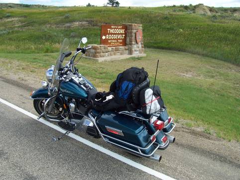
Friday was the north unit of Theodore
Roosevelt National
Park.
Reading that the visitor center opened at 9 AM, I left the hotel at 8 AM
Mountain Time figuring that the one
hour drive would put me at the park at opening time to get my passport stamp.
What I did not count on was that the time zone line between Mountain and
Central times twists and turns all over in that area, and the park sits just
inside of the Central time
zone. Therefore the visitor center
actually opened at 8 AM Mountain Time, and I could
have started my day one hour earlier.
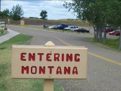
Given the long drive across Montana
I had ahead of me that would have been a nice thing.
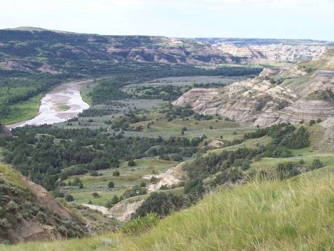
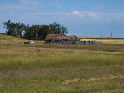
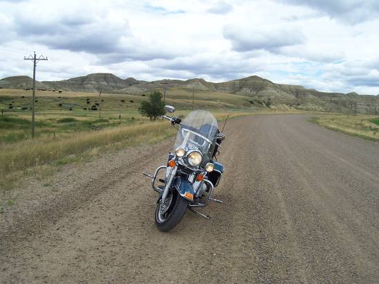
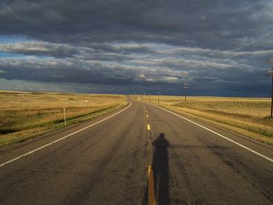
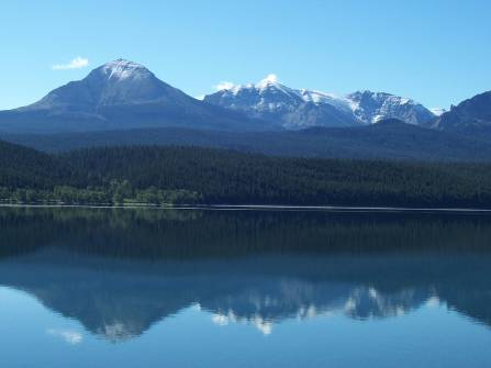
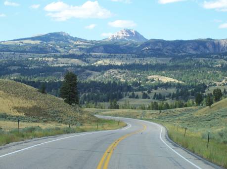
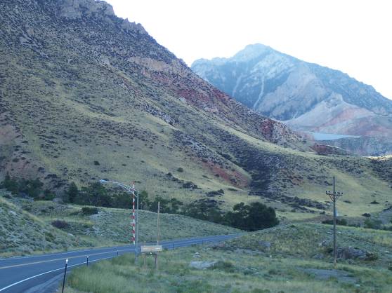
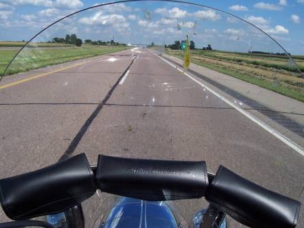
As I was heading north on Hwy 85 though North Dakota, here
are two pictures that are typical of the scenery.
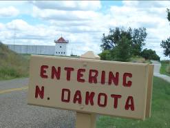
Straddling the border between North
Dakota and Montana
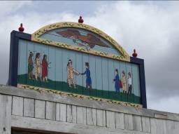
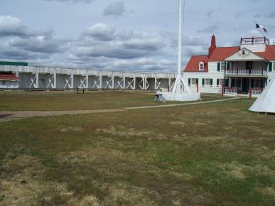
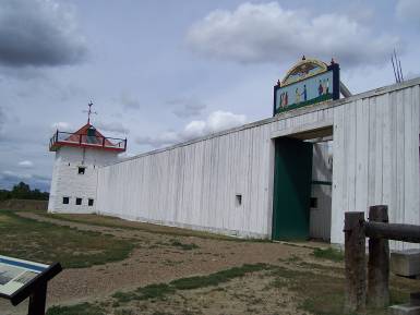
is the Fort Union Trading Post. This was
not a military fort, but was one of a string of trading posts owned by John
Jacob Astor. His goal was to control the entire fur trade in the West. I found it quite interesting that the history
of the place tells how in the 1840’s there was profitable and peaceful trade
with the many Native American tribes in the area. In the closeup
of the façade, note the Native Americans on one side, and the Europeans on the
other and them shaking hands on a deal in the middle. By the 1860’s the US military
presence in the area increased and the trade fell off making the post
unprofitable. (Not a coincidence I think.) This is a reconstruction of the
post, as the original was torn down in the 1860’s and the materials were used
in construction of the military fort.
After seeing the Trading Post, given that my destination was
400 miles west, I decided to go west on a 16 mile stretch of gravel road,
rather than backtrack that far east again on the
asphalt road. This was the longest section of gravel road I had ever taken on
the Road King, and as will be seen was good practice for other roads to come.
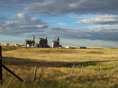
I then got rolling on US 2 across northern Montana. Here are two images that are
representative of about 400 miles of that road. Note that I could stand in the
middle of the road and take my time with a picture with virtually no fear of
other traffic.
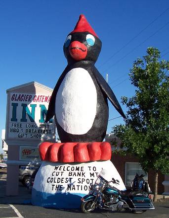
Friday night got me to Cut Bank, MT where I stayed at a
small family owned hotel. It was after I
was checked in and sitting in my room that I discovered that the freight train
tracks were about 50 feet from my window.
They were down a small embankment and behind a row of trees, so I did
not notice them until the room started shaking from the engines going by. Note
the saying below the penguin. Saturday
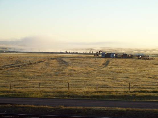
morning when I left it was 37 degrees (on August 13)! The entire bike was
frosted over. I was very glad the I
brought the electric jacket, and the new rain gloves
were pressed into service along with the heated grips to keep my hands
warm. Notice all the fog coming off of
the stream in the distance.
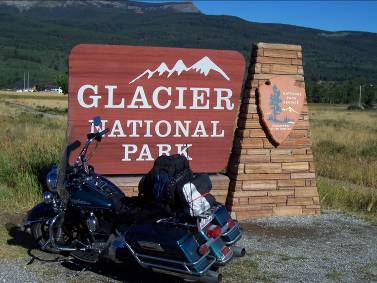
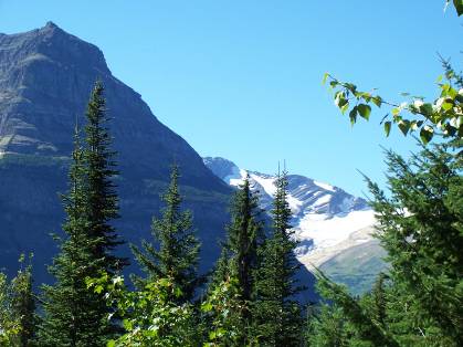
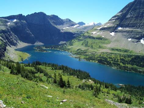
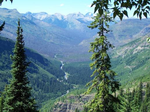
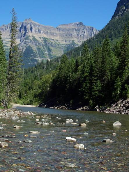
The goal for Saturday was Glacier National Park
and a drive on the Going To The Sun Road. I took the road going east to west. The two
days prior to my arrival I was told it was gray, cold, rainy, snowy, and foggy
in Glacier with Logan
Pass completely in the
clouds. The day I was there was crystal clear, sunny, unlimited visibility and
crisp temperatures like a nice fall day.
The pictures came out really well, but there is no way a photo can
capture the true beauty and scale of the place.
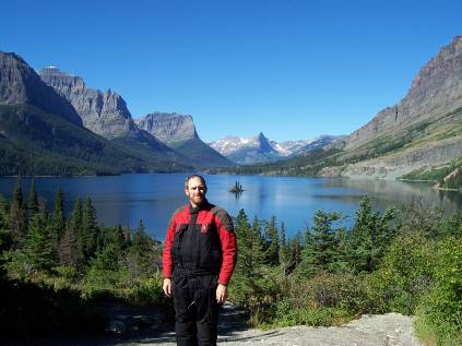
Here I am in front of Goose
Island, and a picture of the last of
the glaciers at Glacier
Park.
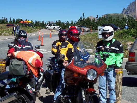
While in the park I came across a family of four traveling together
on three 1970s vintage BMWs with Wisconsin Collector license plates. One son was riding as a passenger and I was
told he had his own 1970-something BMW at home but he is not old enough to ride
it on the road yet. I was told that when
they got married the husband had 26 bikes.
They have pared it down some in the intervening years.
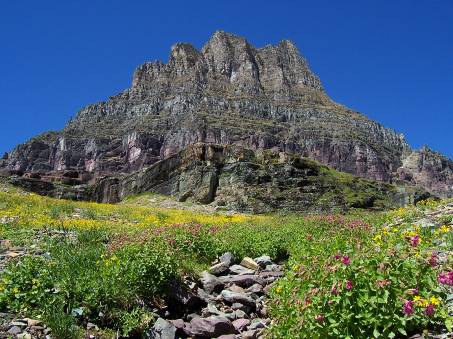
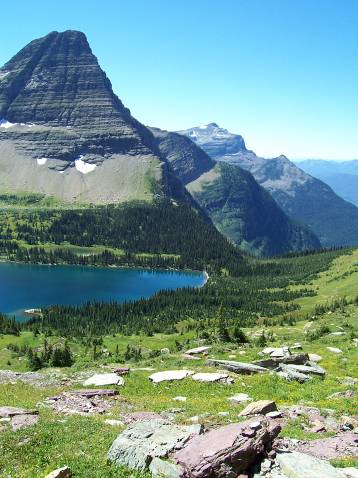
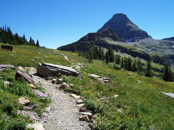
Here are four pictures from my 3 mile hike to Hidden Lake
at Logan Pass. As I said it was a gorgeous day.
Here are two other photos I took along the way on the rest
of the Sun Road.
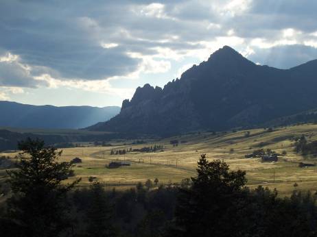
After Glacier I went down MT 83 through the Swan Lake
area. This is a beautiful scenic drive
past mountain lakes, and through state forests with mountain ranges to the east
and west. At the south end of MT 83 I headed west on MT 200 to spend the night
in Missoula. MT
200 follows the Blackfoot river and winds on great sweeping turns through the
mountains. A great end
to the day.
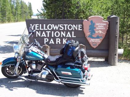
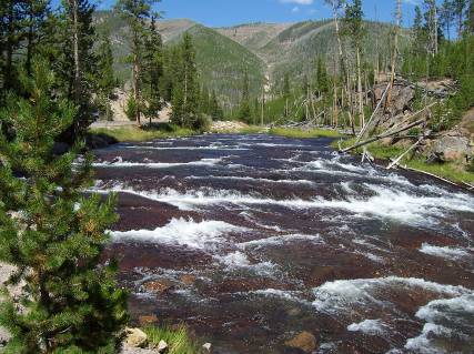
Sunday’s goal was to get at least as far as Cody, WY. I made stops at the Grant-Kohrs
Ranch in Deer Lodge, MT and Yellowstone to add
two more stamps to the Parks Passport.
Since I have been to Yellowstone before I stopped long enough for a few
pictures of the typical Yellowstone scenery, a
passport stamp, and headed through the northern branch of the loop road and out
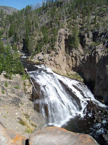
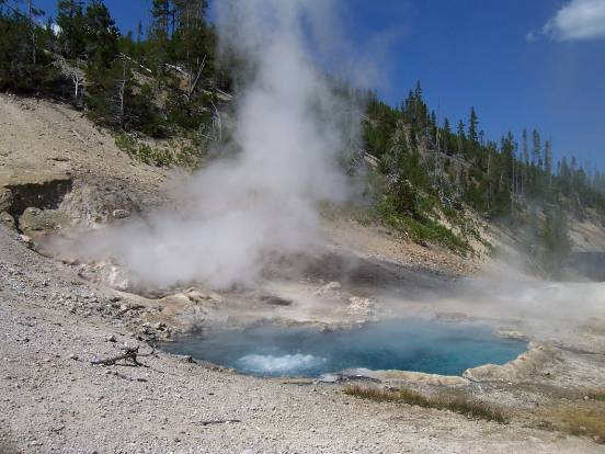
the Northeast Gate. These photos are of a bend in the Gibbon
River, Gibbon Falls,
and Beryl Hot Spring.
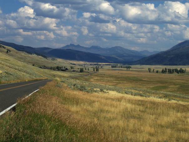
I have always loved
the broad sweeping scenery of the Lamar
Valley in the North East corner of Yellowstone.
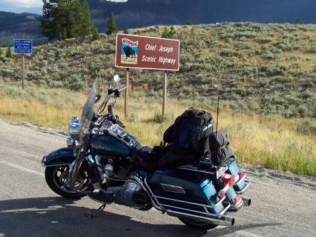
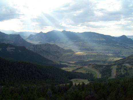
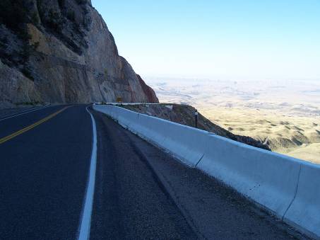
Then a short ride on the part of the Beartooth Highway
that is still open between the Yellowstone NE gate and the Chief Joseph Highway. Note that even this section is under
construction and has many stretches of gravel road. It looks to me like they are widening and
straightening the road. The Chief Joseph is everything that people have
said. The scenery was again spectacular,
in a trip full of one incredible view after another. Here are some of what I think are the best
views along the way. I would love to
take the road from south to north next time (There will be a next time!) and
see a whole new set of great views.
I made it as far as Powell,
WY Sunday night, about 40 miles
past Cody. I was right on schedule.
Monday I continued east on Alt. 14 from Lowell
to Ranchester Wyoming. This route heads straight over the Big Horn
Mountains on the Medicine
Wheel Scenic Byway. The plaque at the
road says it was originally built in the 1920-1930 period for $30,000. It was then washed out and took from 1963
until 1985 to rebuild it at a cost of many millions of dollars. From the west you go almost straight up the
side of the mountain on sections of road essentially bolted to the side of the
cliff. This is not a road for someone who is unsure of their corner skills.
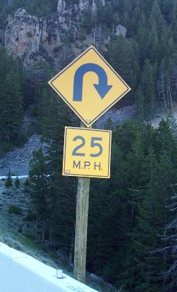
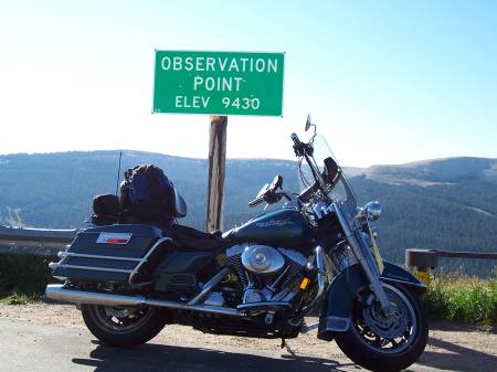
Once on top you cross Observation
Pass at 9430 feet. Note
the red and white striped gate for closing the road during the winter. After I
saw this road sign about 6 times in just a few miles and I had to stop and take
a picture.
Alt 14 then joins up with US 14 to continue down the east
side of the Big Horn mountains on some absolutely fantastic winding road.
Countless turns and switchbacks, pretty light traffic, good clean smooth
pavement, and with a view that (like the song says) on a clear day you can see
forever. Eastern
Wyoming is spread out before you as far as the eye can see. I strongly recommend the US 14 and Alt
14 route to anyone looking for a great ride.
After a rather welcome 150 straight miles on I-90, I turned
up US 14 again to get my next park stamp at Devils Tower.
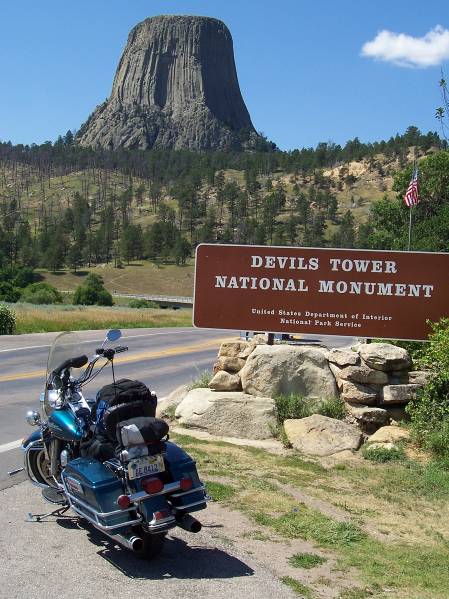
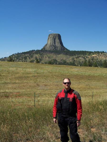
I then continued around on Wyoming state highway 24, which is another
wonderfully scenic road with endless sweeping turns through the hills. Make
sure you have enough gas, since after Devils Tower
the next gas station is over 70 miles away.
There is a gas station at Devils
Tower, but I did not fill
up since I thought I had plenty. I did
not count on it being 70 miles and although I did not run out, I had only about
25 miles left. I was very glad I packed
two bottles of extra gas in the saddlebags as insurance. Next, the Black Hills of South Dakota…..
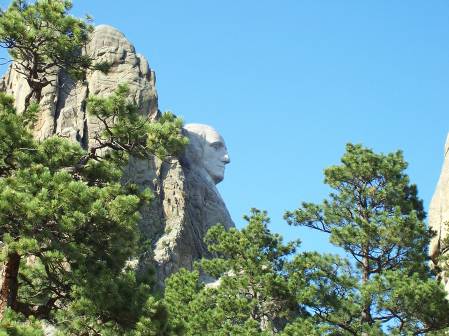
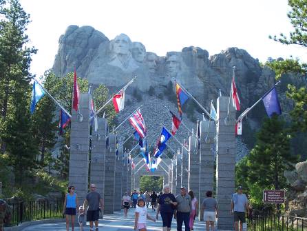
From Spearfish, SD I took Highway 14A south through the
Spearfish Canyon area of the Black Hills and around to Lead, SD, then down 385
and east on 244 to Mount Rushmore for another passport stamp. I do not have any pictures of the Black Hills area as it was getting late and I just needed
to keep riding. The first view of George
Washington comes up unexpectedly on highway 244. I was just cruising along and
rounded a corner and there it was. I
blew right past the scenic turnout and had to turn around down the road to come
back.
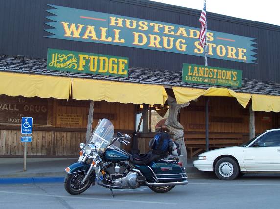
I then hit I-90 at Rapid
City and headed east for about 50 miles to end the day
at Wall, SD. Home of the famous Wall Drug.
Tuesday’s goal was to get back to Chicago, but first I had two stops to
make. With all the riding I had done I
never had a chance to pick up a gift for my wife. (The one
condition of this trip without her.)
Up to this point I either needed to put miles behind me or when I went
looking for a store it was so late the shops were closed. Fortunately Wall Drug
opens at 6:30 AM and is a small self-contained mall, with shops of all types.
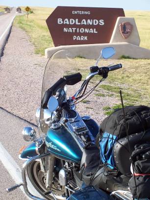
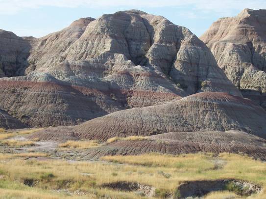
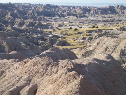
As the final stop of the vacation, a drive around the scenic
loop at Badlands National Park and one last passport
stamp.
At last time to hit I-90 for the long drive back to Palatine, IL.
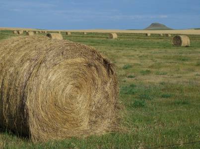
I can say that South
Dakota is all ranch land with some gently rolling
hills. The western half of Minnesota
is totally flat and is corn as far as the eye can see. The eastern half of Minnesota has some
hills, but still corn and more corn.
This was the first time that I have approached La Crosse, WI
from the west and the bluffs and hills are quite impressive. I had forgotten how nice the far west end of Wisconsin is. Below is the view for most of the 13 hour
ride. I was back in Palatine at 11:30 PM
(and looking mighty tired), after covering 3770 miles in 6 days, getting 9
passport stamps in four states, and seeing far more scenery than I can possibly
convey here. This will be a tough trip
to top.
Summary of a few lessons learned:
- Doing two
SS1000s was the best preparation possible for this trip. After each of these rides I made
additions and corrections to the setup of the bike to make it comfortable
for the long haul.
- I
credit the postings on the MTF for putting me on to LD shorts, powder and
an AirHawk cushion. Without all three of these the ride
would have been much less comfortable.
- An XM
radio is a wonderful companion.
- Always
pack the electric jacket, even if it is the middle of August and you do
not think you will need it. I did bring
it, and was very thankful. I ended up being in the “right” place to ride
in record-setting cold temperatures for August. (I also brought a cooling vest and used
it for one day as well.)
- Future
vacation planning will not include an 800+ mile ride on the last day.
- Jewelry
is still a good gift.